Arapahoe Basin
May 1999
Getting There
Here are pictures form a short ski trip to Arapahoe Basin in the
Rocky Mountains in Colorado. Despite my numerous trips to Colorado in the past, I never
skied here before. I was in for a major treat! Experience its rugged Alpine beauty,
like I did at the end of May!
To get there, one flies to Denver
International Airport, an ultramodern facility located in the plains north of the city.
Luckily, United Airlines has a direct flight from New Orleans that takes just a little
over 2 hours. In Denver, one rents a car and drives from
airport south to Interstate 70 and then west into the mountains.
The mountains rise to more than 10000 feet above the surrounding high
plains to the east that are themselves approximately 5000 feet high. (Compare that to the
Snezka mountain in the Czech Republic, the country's highest peak, which is 5254 feet
(1602 meters) high.)
On the way one sees gold and silver mines, some abandoned, some still
active, nested on the hillsides. One of these old mining communities is a charming little
ghost town called Silver Plume.
Interstate 70
runs westward through a wide valley, continuously rising from the plains around Denver
to over 11000 feet at the
Eisenhower Tunnel. To help you
visualize the situation, imagine driving up a ramp onto an elevated highway. Now imagine that
incline being nearly 20 miles long!
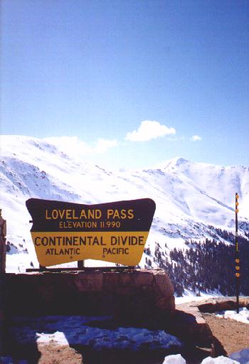
The Eisenhower Tunnel runs underneath the 14000-foot (4000-meter) peaks
of Loveland Pass and is said to be
the highest vehicular tunnel in the world. At its eastward entrance (toward Denver) its elevation
is 11012 ft (3359 meters).
Immediately before reaching the east entrance of the tunnel, one exits
Interstate 70 and takes Highway 6 south through Loveland Pass. Highway 6 is the old highway that provided
a link between eastern and western Colorado until Interstate 70 and the tunnel were built
in the 1960s and 70s. Highway 6 is still being used by trucks carying hazardous cargo, considered
too dangerous to pass through the tunnel. Here, the true mountain driving experience begins.
The road, a narrow undivided two-lane, rises to another 1000 feet via a series of hairpin
turns to Loveland Pass and the Continental Divide.
Although somewhat dangerous because of heavy trucks, this otherwise is
a wonderful performance-driving experience. In other words, a real opportunity
to test-drive my rented Mustang GT convertible.
From the Continental Divide, one descends back to
10,800 feet (3,292 meters), the base of the Arapahoe Basin ski area.
"The Legend"
Arapahoe Basin Opened in 1946. The ski area is situated in a glacial bowl
on the north flank of a 14000 foot (4200 meter) peak that, curiously, does not seem to have a name.
Together with the neighboring Loveland ski resort, Arapahoe Basin is one of the highest places to ski
in the United States.
The skiable area in Arapahoe Basin is not nearly as those in
Vail or
Keystone.
But it is so much more beautiful! While the mountains in Keystone or Vail
are barely above the treeline (about 10000 feet in Colorado) and have a rounded and somewhat
docile appearance, the peaks around Arapahoe Basin are wild and jagged with an Alpine character.
One more comparison must be made. Although the mountains in Vail and Keystone
are higher than in any point the the Czech Republic and higher than many areas in even in the Alps,
Arapahoe Basin is over 2000 feet (600 meters) higher! That may mean less oxygen, but also
snow lasting well into June, some seasons even into July.
While the rounded wooded mountain tops of
Vail or Keystone give you the feeling that you are somewhere in the Krkonose
("Giant Mountains", Riesengebirge) area, the above-treeline bowls of Arapahoe Basin
gives you a feeling of skiing in the Alps.
Perhaps it is because of its untamed natural beauty and skiing challenge
that it has become known in the skiing circles of Colorado as "The Legend".
Pictures
 SW view of Arapahoe Basin from Loveland Pass.
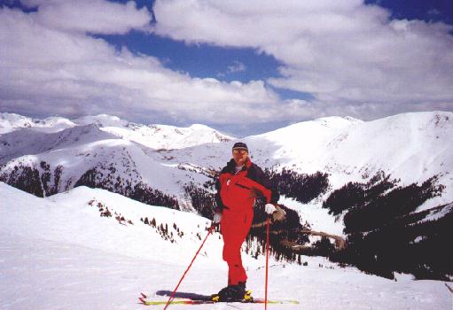 Radim on top of the ski area
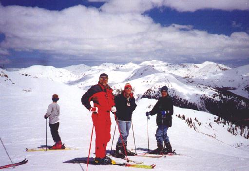 Radim, Mike and Jeff in the same location
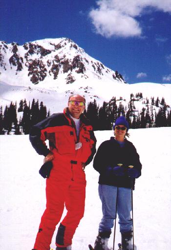
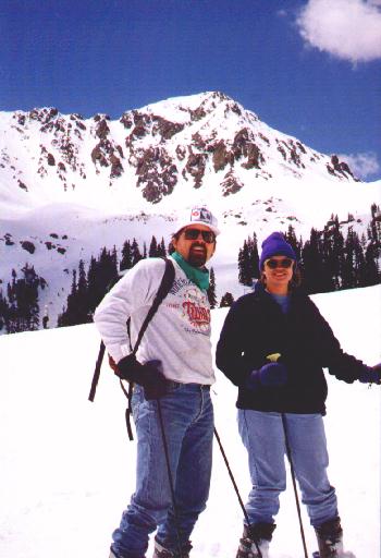 Rob and Rosie in front the unnamed 14000 foot peak
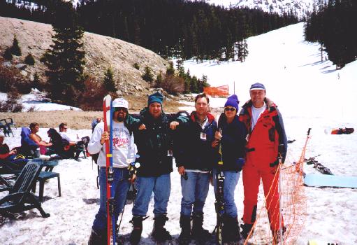 Rob, Jeff, Mike, Rosie and Radim on the base of the mountain
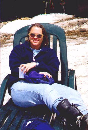 Rosie is comparing the Colorado sun to London's...
 Radim and Rosie
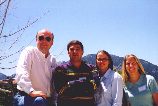 The Geologists...
To see where some of our pictures have been taken, look at this map.
Pertinent links:
1.- Arapahoe Basin official site
2.- A good info server about skiing in the Rocky Moutains
3.- Our ski page
4.- Interstate Highway 70
(c) 1999 - Radim and Lisa Kolarsky
Last updated on July 2, 1999
created with unix vi editor
"real men use vi"
|
|